
Ponderosa, Puerto Galera: The View From Mt. Malasimbo
A mountain golf course and viewpoint above White Beach, looking down over the bays and out across the Verde Island Passage.
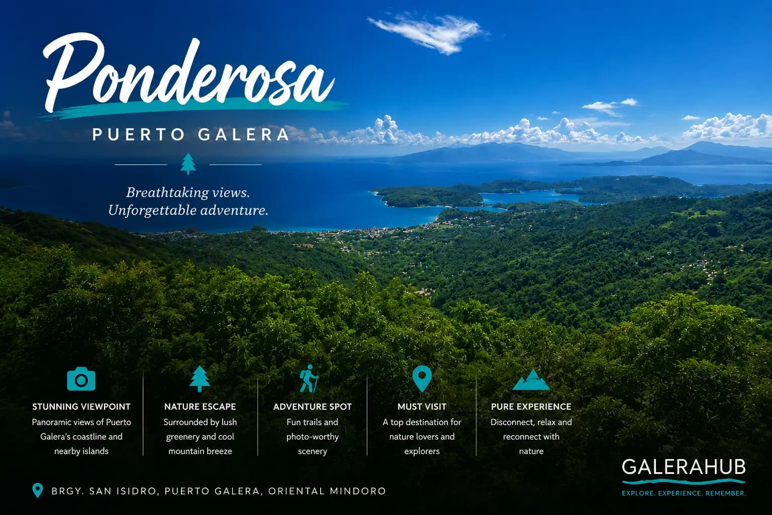
Everything else in Puerto Galera happens at sea level. Ponderosa is the exception — a golf course and viewpoint cut into the slopes of Mt. Malasimbo, up the mountain road behind White Beach, where the temperature drops and the whole peninsula lays itself out below you.
The provincial tourism office lists it under San Isidro — the White Beach barangay.
The view is the point
On a clear day you are looking down over Puerto Galera's bays and out across the Verde Island Passage — the same channel the dive boats work — towards Luzon. The resort says Taal volcano is visible from up here in the right conditions. Whether you catch that depends entirely on the haze, and the haze depends on the season.
From sea level, Puerto Galera is a series of separate beaches. From up here it is obviously one peninsula.
What the height actually gives you is the shape of the place. The bays that feel like separate destinations when you are moving between them by tricycle — Sabang, the Lagunas, Muelle, White Beach — resolve into a single indented coastline with islands sitting off it, and the mountains behind you turn out to be most of the land. It reorganises the map in your head in about a minute.
Go early. Mornings are clearest, the light is better for photographs, and the climb is far more pleasant before the middle of the day.
What you can actually see, and when
The long view is a seasonal thing. Through the amihan — the northeast monsoon, roughly November to February — the air is drier and cooler and the far side of the passage is often sharp. Through the habagat, roughly June to October, it is more often soft: cloud builds against the mountain through the day and the horizon closes in.
Either season, the pattern within the day is the same. Cloud forms on the slope as the land heats, so the window is the morning. Sunset from up here is popular and can be extraordinary, but it is the shot that most often fails — by late afternoon the mountain has usually made its own weather.
The golf course
Ponderosa Golf and Country Club describes its course as nine holes, par 30, laid across roughly 22 hectares of mountainside, at what it puts at 2,000 feet above sea level. Those are the resort's own numbers.
It is a mountain course in the literal sense — the ground moves under you constantly and very little of it is flat. Clubs and caddies are available on site, which is the practical answer for almost everyone: nobody carries a bag up here on a Puerto Galera holiday.
You do not have to play to go. Most people who make the trip are there for the view and a cold drink at altitude, and the course is the reason there is anything at the top at all.
Getting up there
The road climbs steeply from the White Beach side. Three sensible options:
- Tricycle. The standard way. Agree the fare including the wait and the ride back down — this is not a road where you will flag something down on the way out.
- Motorbike. Fine if you ride, and only if you ride. The gradient is real and the surface is not uniformly good.
- On foot. People do walk it. It is a proper climb in tropical heat, so take water and start early or leave it for late afternoon.
The bit people underestimate is the return. A tricycle that dropped you off is not going to be waiting unless you arranged it, and walking down a steep road in the dark is a worse idea than walking up it in the heat. Fix the way back before you commit to the way up.
What to bring
- Cash. Getting up there, and anything you eat, drink or hire at the top, will not take a card reliably.
- Something with sleeves. It genuinely is cooler at height, and the breeze is constant.
- Time in the morning. Afternoon cloud builds against the mountain and the long view is the first thing to go.
- More water than the walk seems to need. There is nothing between the bottom of the road and the top.
Above the reserve
The forest on these slopes is part of Puerto Galera's UNESCO Man and the Biosphere Reserve, designated in 1977 — the same protection that covers the reefs you can see from the top. Standing up here is the clearest way to understand what the designation actually covers: forest, mountain and water as one system rather than three attractions. See A UNESCO Biosphere Reserve.
It is also the one viewpoint from which the connection is obvious rather than theoretical. The water coming off these slopes reaches the bays you are looking at, and the reefs in those bays are what the dive boats and the island-hopping circuit are built on.
Where it fits
Ponderosa pairs naturally with a White Beach stay — up in the morning, back on the sand by lunch. If you are collecting the inland half of Puerto Galera, add Tamaraw Falls and the Iraya-Mangyan Village. The rest is in Famous places & landmarks.
References & sources
- Provincial Government of Oriental Mindoro — Ponderosa Golf and Country Club, Travel Oriental Mindoro(location in San Isidro).
- UNESCO — Puerto Galera, Man and the Biosphere Programme (MAB), designated 1977.
A note on the elevation: the “2,000 feet” figure is the resort's own. Other sources describe the site as roughly 400 metres up, which is not the same thing — so we have attributed the number rather than asserting it.
Founders of GaleraHub focused on trust-first local marketplace operations in Puerto Galera.
Have a story to share about Puerto Galera?
Tips, guides, seller spotlights — tell us what the community should know.
Pitch a story